Carry speed with no pedals

The Adirondacks and region offer trails around the area. Long Lake has backwoods trails for the adventurer and will soon have a small park all on its own.
This area boasts mixed terrain, trails through back trails and old logging roads through forest and and up and down elevations.

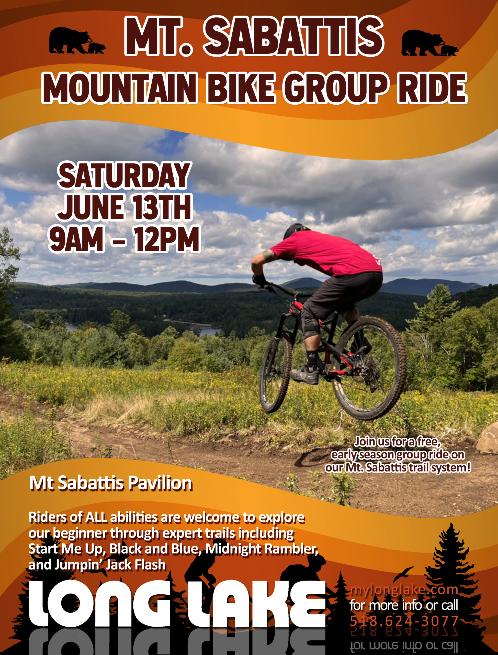
Mountain Biking at the Mt. Sabattis Recreation Area in Long Lake, NY, located at 6 Pavilion Way offers an excellent opportunity for the Town of Long Lake to provide a high quality mountain bike riding experience for its community members and visiting recreationist. The location, terrain, park infrastructure and views all combine to provide the opportunity for the town to create an excellent recreation experience. We offer a growing network of machine-built trails, offering a great variety of rides, from narrow singletraack to wider bench cut trails with rollers, berms and plenty of flow.

MOUNTAIN BIKE TRAIL DESCRIPTIONS, Mt. Sabattis Recreation Area, 6 Pavilion Way, Long Lake, NY
START ME UP (.75km) An intermediate, TWO-WAY, machine-built trail beginning at the Northeast corner of the tennis courts. This flowy trail follows the terraced section of Mt Sabattis before winding through the woods and emerging in the Pavilion parking lot. Some features include a pump section, hair pin turns and a bridge crossing, and is equally fun riding in both directions.
LET IT LOOSE (.75km) A beginner, TWO-WAY, machine-built trail that is the perfect warmup or introductory mountain bike trail. This trail is slightly wider than the others and features both woods and field riding, including multiple bridges and rollers to help new riders work on basic mountain bike skills.
BLACK & BLUE (1.25km) An intermediate, TWO-WAY, machine-built trail traversing through woods and the fields. Slightly narrower trail than Let It Loose, expect higher speeds, tighter corners, and larger rollers than the beginner trails, but is still very approachable for novice bikers.
WAITING ON A FRIEND (.3km) A beginner, TWO-WAY, machine-built spur trail that branches off Black & Blue on east edge of the field. This trail is very flat and wide is a good spot to stop for a quick breather while riding, or a good spot to let the dog get a drink of water.
PAINT IT BLACK (1.25km) An expert, machine-built trail with two distinct sections. The first section is a TWO-WAY trail branching off Black & Blue climbing up Mt Sabattis as it winds through the woods, eventually crossing the field and entering the woods on the eastern side of the property before eventually merging with the Powerline/Northville-Placid Spur Trail. The second section starts as you emerge from the NPT Spur Trail and becomes a directional ONE-WAY downhill trail with a machine-built jump line featuring tabletops, step-ups, and a rock drop. All the features are rollable, but do not have any ride arounds.
MIDNIGHT RAMBLER (1.2km) A wooded and winding trail through the upper area of the Mt Sabattis Recreation Area with multiple switchback turns and some mellow roller jumps. This trail is rideable in both directions, although it flows better to ride it counter-clockwise. The star of this trail is the bermed hairpin corners as you descend.
Mt. Sabattis Mountain Bike Trails: Long Lake, New York
Trail map on Trailforks ap: Link Here
The Mt. Sabattis Mountain Bike Trails network has 5.5k/3.4 miles of single-track on nearly 70 acres of land. With trails and a spur, they may be short, but the trails offer a great variety of rides, from wider bench cut trails with rollers, berms, and plenty of flow.
Trails include a climbing trail, an easy, family-friendly trail, intermediate and a technical expert trail which will have riders coming back for more.
Wilderness Property Management built the trails over four years and they refine them regularly to keep fans coming back.
Difficulty: Trails for all experience levels
Length: 3.4miles / 5.5K on 70 acres of Town owned land.

McRorie Lake/Cedarlands –
End of Kickerville Road in Long Lake, NY Limited Opening from August 23rd until June 23rd – so it is open during mud season. Not open to public during summer months
General information on biking includes how-to and safety tips with links to rules & regulations
Fishing Camp Trail is open to biking and extends 4.0 miles from the trailhead to the northeastern shore of McRorie Lake. The first 0.4 mile of the trail is located on the Kickerville Road. The trail passes Mud Pond then runs parallel to the shores of McRorie Lake and with small ascents and descents along its length. Beyond the Mud Pond Hand Launch Site (approximately 0.75 mile from the trailhead) the trail is open to the public for biking from August 24 – June 23.
Bikers must remain on the section of trail between Mud Pond and the McRorie Lake Outlet (the Base Camp Area). Accessing the private lands adjacent to the trail is prohibited.
McRorie Lake Trail leaves the Fishing Camp Trail approximately 2.1 miles from the trailhead at the junction of three trails. The trail extends 0.5 mile at the end of a point on the southwest shore of the lake. The trail is open to the public for biking from August 24 – June 23.
Source: https://www.dec.ny.gov/docs/lands_forests_pdf/mapcedarland.pdf

Essex Chain of Lakes, Newcomb NY
Nearly 20 miles of administrative roads in the Complex are open for bicycling. The roads open for bicycle use are in the Bike Routes Map (PDF 1.0 MB) and in the following list:
8.5 miles of the Chain Lakes Road North from the Goodnow Flow Road to the Cedar River
1.5 miles of the Drake’s Mill Road from Chain Lakes Road North to the Hudson River Access Site at the Polaris (Iron) Bridge
2.5 miles of road from the Chain Lakes Road North to the Deer Pond Parking Area
2.5 miles of road looping around Deer Pond
0.3 mile of road from Chain Lakes North to Jackson Pond
3.0 miles of the Chain Lakes Road South from the Outer Gooley Parking Area to the Cedar River
1.0 mile of road from the Chain Lakes Road South to Pine Lake.
The Essex Chain Lakes Road South can be accessed from the Deer Pond Parking Area can be accessed from the nearby community of Newcomb.
Biking is prohibited beyond the Polaris (Iron) Bridge into the Vanderwhacker Mountain Wild Forest.
Bicyclist should not travel on the Goodnow Flow Road beyond the intersection with the Chain Lakes Road North. The Goodnow Flow Road becomes a private road shortly after the DEC sign for “Essex Chain Lakes and Hudson River Access” sign at the intersection with the Chain Lakes Road North. Turn left at the sign on to the Chain Lakes Road North.
Source: https://www.dec.ny.gov/docs/lands_forests_pdf/mapessexbike.pdf

Great Camp Santanoni in Newcomb –
PDF Map – NYS DEC WEBSITE
This is a wide carriage dirt road to a Historic Great Camp in the Adirondacks. A multi-use trail that allows in summer biking, hiking and horseback riding; in winter x-c skiing, snowshoeing (I’m not sure about fat tire).
In the summer there is a horse and cart that take people, canoes/kayak and cyclists (I know of one time they helped a guy with a flat tire out)
The trail has a peak at about 3 miles in (or 1.5 miles out) so you get a nice down hill ride into the camp and out the parking lot.
Scenic wide carriage roads ideal for outdoor adventures featuring spectacular views of the High Peaks Wilderness as well as Adirondack Great Camp history.
Location: Newcomb, NY. Essex County.
9.4 mile out-and back (4.7 miles one way).
Well-maintained, wide dirt and gravel carriage road.Easy to moderate (due to length).
340 ft. Flat and gently rolling hills.
Hiking, mountain biking, cross country skiing, snowshoeing.
Caution: This is considered “Wild Forest”. Carry maps, compass, rain gear, insect repellent, water and snacks.
Muti-use trails. Also vehicles such as horse-drawn carriages and state maintenance vehicles use the carriage roads. Avoid durng the “wet season – spring run-off” or after heavy rains.
Source: https://www.dec.ny.gov/docs/lands_forests_pdf/mapcampsanta.pdf

Popular mountain bike trails near Raquette Lake
The 22-mile Limekiln Lake-Cedar River Road is a seasonal access road which runs through the Moose River Plains Complex and can be used with other roads and highways to travel between Inlet and Indian Lake.
Seventh Lake Mountain Trail extends 12.8 miles between Limekiln Lake-Cedar River Road and Sagamore Road.
Old Uncas Road Trail extends 7.2 miles between two trailheads along State Route 28 – one across from the Seventh Lake Boat Launch and the other across from Eighth Lake Campground.
Mohegan Lake Trail leaves the Old Uncas Road Trail 2.7 miles from the Eighth Lake Campground Trailhead and connects with Mohegan Lake Road then Sagamore Road.
Alot of long hills on the gravel road, mostly up on the way in. The road will take you to, and around, Mohegan Lake, but on the way back out, you will see a snowmobile trail that breaks left. This trail is a good ride, and it will take you out to Eighth Lake on Rte 28. The trail continues past Rte 28, but this is a good place to turn around. It’s approx. 8 – 10 miles out and back
Bug Lake Trail extends 3.2 miles between Uncas Road and Eighth Lake Campground through which bikers can connect to the Seventh Lake Mountain Trail.
Mike Norris Trail extends 2.5 miles between the Bug Lake Trail and Uncas Road.
Otter Brook Trail extends 6.6 miles from the trailhead located at the end of Otter Brook Road. The trail follows along the Otter Brook and the West Canada Lake Wilderness boundary.
In addition to the trails, bikers can use Uncas Road, Sagamore Road and State Route 28 to create long distance cycling trips.
Muti-use trails. Also vehicles such as horse-drawn carriages and state maintenance vehicles use the carriage roads. Avoid durng the “wet season – spring run-off” or after heavy rains.
Source: https://www.dec.ny.gov/docs/lands_forests_pdf/mapcampsanta.pdf